Hot Post Of The Month

Sep 8, 2020

Critique Of Alberta's Iron Horse Trail

Welcome to BikeBike Adventure TV!  "We do these trips so you don't have to!"

Well, we tried, and failed at bikepacking the full length of Alberta's Iron Horse Trail. 

We thought we did enough homework. We knew the trail was not optimized for bikes. We knew it would be slow going in spots. But we persisted with our plans.

What we didn't know it would be impassable in many places. We didn't know the trail was completely ripped up from Bonnyville to Cold Lake. Like ripped up completely by water main construction for 40+ kilometres.

Now you know.  

In short, we'd recommend avoiding this trail for bikepacking.  

Strava Link Day 1

Strava Link Day 2

Strava Link Day 3 


However, the route itself is beautiful, the towns it passes through are cute, full of history - and slowly dying - and a lot of the infrastructure that is already in place is useful for touring cyclists. More on this at the end of this post.

And so it begins...

 
Our journey begins in Waskatenau, pronounced "Wah-Set-Naw". The are no services here but there is a truck stop, restaurant, liquor store, and gas station on Hwy.28 just a few hundred metres down the road.


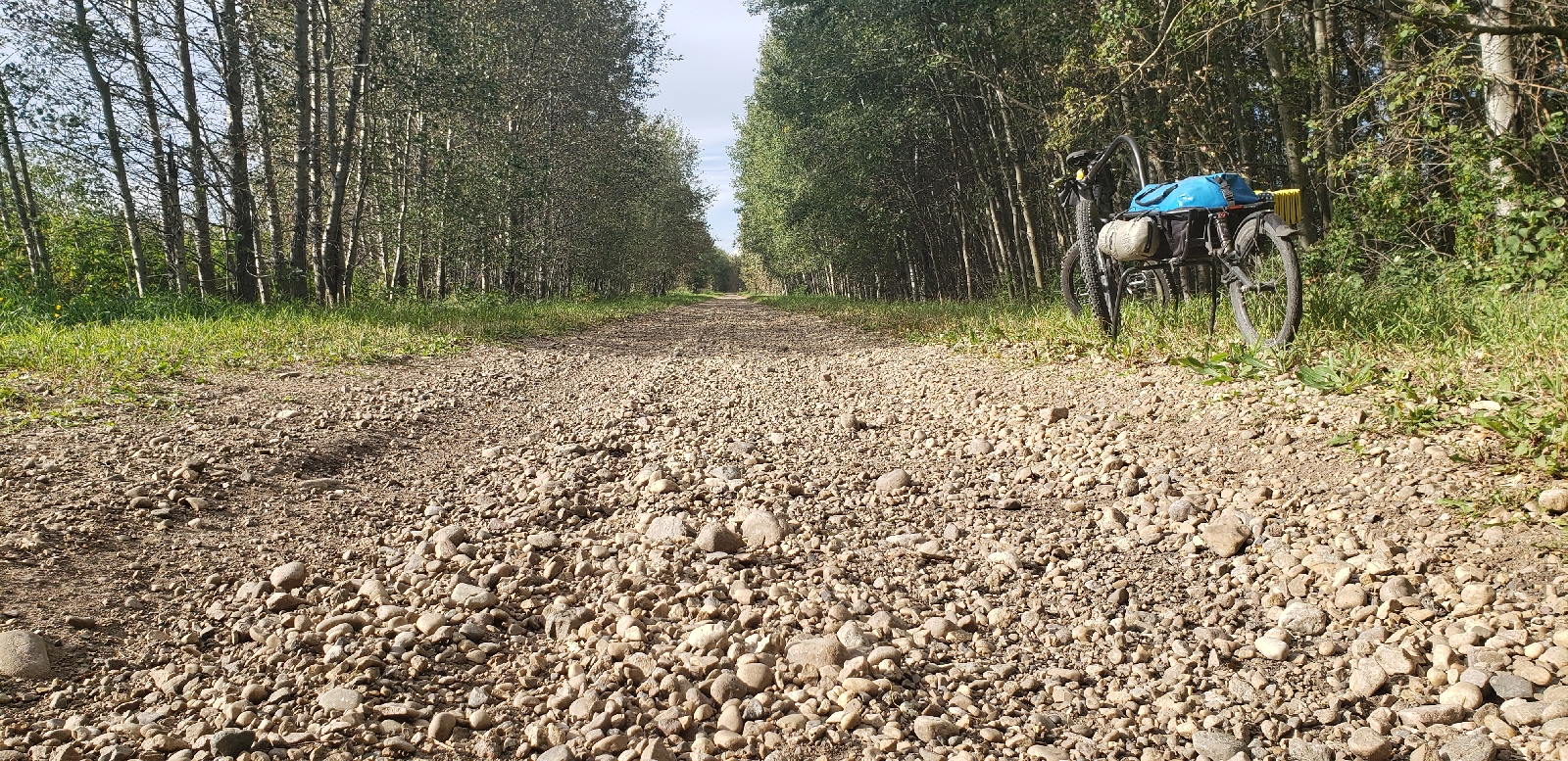
The trail starts just east of the Waskatenau townsite on a decent enough double track. Kinda soft, kinda rough, slower than a comparable gravel road, the going was slow but manageable. 


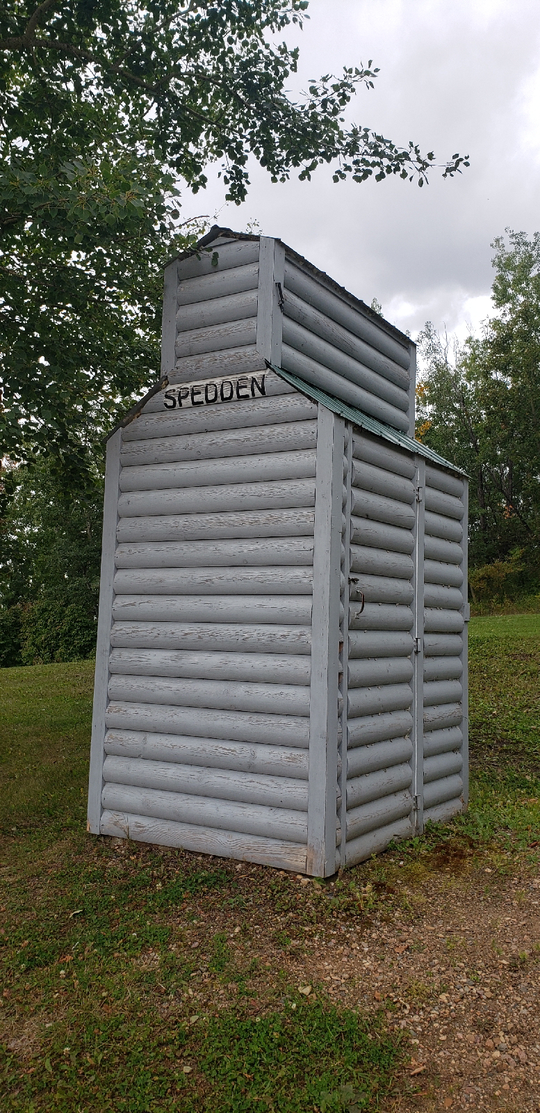
Along the trail there are well maintained, clean outhouses at all Staging Areas. A very nice feature. Some of the staging areas had benches/tables and fire pits too but you could tell they were never used. This one was a bit of an oddity, located just west of Smokey Lake in a wooded area. 


Smokey Lake has done a very nice job of restoring and maintaining the original train station. Washrooms were available, the grounds around it were lovely, and it even had a little museum inside. We picked up more water here knowing there was likely no services until Vilna which we were aiming to arrive at tomorrow. One of the challenges on this trail is where to find water since the trail runs through farmland full or crops and cows. We loaded up with all the water we would need for dinner, breakfast, and enough to get us to Vilna.
 
 
After Smokey Lake the trail heads into a marshy valley and the trail surface started to get really soft in spots as we headed towards the Edwand area. It was quite beautiful - which helped make the slog somewhat worthwhile - until it wasn't. 
 
After Edwand the trail more or less turned into a beach - we called it Bellis Beach - for many kilometres. Incredibly slow going, energy zapping, and frustratingly difficult to maintain any momentum - kinda like riding uphill for a long time with no rewarding descent afterwards.


We arrived in Bellis with enough sunlight to set up our tents before the sun went down, posting up in the staging area near the outhouse. The slog through the Bellis Natural Area - "Bellis Beach" - should be avoided at all costs. There is a road detour available to the north of it and we'd recommend you take it. 


Adjacent to the staging area was this bench which was the only one around and was nice for use as our makeshift kitchen.  There is a "general store" here but it was closed before we got there, not sure of what they may have had available for food and water. 
 
Day 1, done and dusted, we settled in for our first night on the trail to the sounds of barking dogs, howling coyotes, and mooing cows. We were both tired from the sand slogging and hoping for smoother conditions tomorrow.


Day 2 started nice and warm. We were both awake at first light and after a couple coffees decided to push on to Vilna, hoping to find some hot food for breakfast there. No luck on the hot food but there was a grocery store there and the trail was much better - dare I say - even kind of fast for awhile into Vilna.  A sleepy little town, home to Alberta's oldest operating pool hall, wooden sidewalks in the main drag, and a giant mushroom sculpture.

We had an interesting chat with a local gentleman who inquired what we were up to. He'd noticed our bikes and was very quick to opine that he felt the trail was under-utilized, needed investments to make it more useful for the local townsfolk - including paving/improving it so local old timers could enjoy it on their mobility scooters. He also mentioned the trail itself has never seen a grader and has more or less never been improved/maintained since it was first installed decades ago. More on this later.


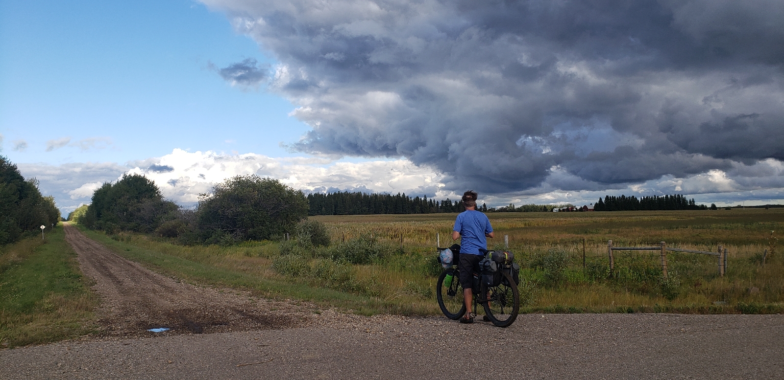
Heading east out of Vilna the trail was still in pretty ok shape. Hardpacked in spots, soft in others, it was a bit of a mixed bag but we were making ok time. Being a Saturday we were expecting to be inundated with OHV users - and there were some - but way fewer than we expected, which was a relief. The forecast rain showers did eventually hit us - which actually seem to send all the OHV users home for the day - that was also nice. 


Before too long we arrived in Spedden, more or less another slowly dying small town, which had a really nice staging area, Mr. Sub, liquor store, and convenience store. The firepit looked like it had never been used and there was a stack of firewood there that looked like it was years old. The grassy area would be perfect to setup a tent for the night.
 
Not knowing what we'd we'd find in Ashmont we each grabbed a sandwich, more water, some snacks, some TBDs (tasty booze drinks), and set off on still-pretty-ok trail conditions towards Ashmont. Not long after we left we were pummeled again by rain - this time the sideways variety - that stayed with us all the way to Ashmont where we were greeted by a little gazebo-oasis. We hunkered down here until the rain stopped, enjoyed some tea, and planned our next move.
 
 
Ashmont's staging area was one of the best we'd seen. The gazebo was big, had a pot-belly wood stove in the middle you could cook on, tables, chairs, another clean outhouse, and just a block away was a store that had the necessaries - including firewood. The pouring rain kept us inside so we didn't explore to see if there was a place for hot food but the basics were there. 

At this point, we were feeling pretty ok about how things were going. We were still moving a lot slower than we had hoped but the rain had stopped, it looked like with was clearing up, and the moisture had helped make the riding a little easier - packing down the trail some. Next stop: Mallaig.
 
 
Abilene Junction is where the Iron Horse Trail splits into 2: One spurs heads NE towards Cold Lake and the other heads SE going through St. Paul and ending in Heinsburg. The segment from Ashmont to Mallaig was - in our opinion - the nicest part of the trail we'd seen thus far.


The rains didn't seem to affect the trail that badly - until we both rolled through a muddy section that we didn't spot until it was too late. It was only 100m long but was sticky enough to clog both our bikes, and in my case, popped the belt off. Not a big deal, we took the time to find sticks and start digging the sticky stuff off our bikes.


Beautiful through the Abilene Junction area. Lots of little ponds, the trail meandered a bit more than previous, the surface was still pretty good, and the sun popped back out.


Hello, Mallaig! Almost done for the day. In hindsight, we probably should have just stayed here since all the comforts were here: Picnic tables, a beautiful firepit with a height-adjustable grill, the building was open and had a stove inside too, tables, chairs, clean outhouse, shady spots, and the porch to hang out on.  
 
We both agreed it was a worthy destination in itself - but we also knew we had to do more kilometres  this day if we were going to reach Cold Lake by the end of the next day - which we had to do since we were meeting Nadia there. After relaxing a bit we set off on the last 16kms towards Glendon.


 More or less immediately we were greeting by very soft and rough trail conditions that persisted all the way to just outside Glendon. Everything had been going so well! What happened?! Those last 16kms took us over an hour and sapped our spirits pretty hard. A very long day finished tough...oof.


A few kilometres outside of Glendon and what did we find? Perhaps a vision of a future Iron Horse Trail that could be usable for all ages and abilities and user groups?
 
What a future Iron Horse Trail should look like. 
 
Glendon has taken it upon itself to show all the communities/counties along the trail, and the provincial government tourism ministry what the Iron Horse Trail should be. They added a paved trail into the ROW giving locals more recreation options and inviting more people to get outside. More on this at the end of this story.
 
It felt like heaven to get off the soft and rough dirt as we entered town. We made it there with a few minutes to spare before both the grocery store and food truck shut for the day. Speaking of the food truck, it had some seriously tasty eats with everything on the menu being home made. The poutine was close to the best I've ever had and the burger was incredible too. What a nice way to end the day. 


Glendon's staging area wasn't as nice as the other we'd seen so we started rolling around town to see if there was somewhere quiet we could post up for the night. Our conversations with curious locals at the food truck made it pretty clear there wasn't anywhere close to town to camp (now we really wish we'd stayed in Mallaig) but the grounds around their giant pyrogy had clean washrooms with running water, picnic tables, and a gazebo. 
 
After inhaling our tasty eats we decided to head back to the edge of town where we'd seen some baseball fields, thinking maybe - just maybe, we could post up inside one of the dugouts. Some shelter was key since the forecast called for more showers and the wind from the north had a real bite to it. 


Success! The dugout was a grand slam. The bench along the back was perfect to lay out our things - including ourselves for awhile - and the shelter was exactly what we needed on what turned out to be a very cold and windy night.  

After 2 hard days on this trail we were both exhausted, sore, and wondering what we were in for tomorrow. We were concerned knowing that the trail was not predicted to get better/faster/smoother but we still had to get to Cold Lake for our meetup. The trail was much tougher and slower than we ever expected. The draw of a soft bed and hotel room was what were were hanging onto as we fell asleep under fast moving clouds.


Day 3 began with a few kilometres of paved heaven but as soon as that was done we were back onto slow, rough, deep, soft gravel that seemed to get increasingly more awful as we headed towards Franchere. It was here that our trip of pavement ended for good. We elected to hop onto the 660 highway that ran adjacent to the trail itself - and that was where the trail turned into more or less ankle deep sand that was unrideable on a bicycle. Both of us were on 2.8" tires and we still could not make any reasonable amount of headway.  

We never set our tires on dirt again. 

We rode into Bonnyville on roads for lunch and a regroup. Do we just wait here for Nadia who was driving up to meet us? Do we try and continue on to the next town? And the next? During lunch the very funny and nice server told us that the trail had been ripped out from Bonnyville all the way to Cold Lake to install a new water main. 
 
Our hearts sank. It was game over for us. Rain showers were all around. A cold wind was blowing in from the north. What a bummer.We finished our meals and liquid courage and decided to ride the highway out of Bonnyville to where the trail could be accessed and very quickly saw that there was no trail to be ridden. Ugh. 
 
Hwy.28 doesn't have a full shoulder, is only 2 lanes, has oilfied service rigs and lots of traffic - and of course - it started raining again. We pinned it to Fort Kent where we hid until the rain ended then continued again on the hell highway down to Ardmore where we decided conditions on that road were too dangerous to continue. 


Well, that was a trip. Lots of learnings. Lots of beauty. Lots of suffering. 
 
With so.
        Much.
                Potential.
 
There were so many moments on the trail where I couldn't help but think back to another rail trail we rode a few years ago and how this trail could be just like it. 
 
I'm referring to the P'Tit Train Du Nord in Quebec. Stay with me here. There are a lot of similarities and so much potential to create a truly world-class tourist amenity on Alberta's Iron Horse Trail.
  • Historic rail line that passes through little towns desperate to stay alive
  • Beautiful scenery 
  • Towns spaced just far enough apart to be an adventure but not too far to make it impossible
  • Lots of the infrastructure is already there in the form of maintained staging areas

While on that trip, we spoke with the owner of one of the auberge's we stayed in and learned a couple of interesting things. 

  • First, the trail represented 80% of the business that hotelier made every year. Touring cyclists literally keep the place alive. 
  • Second, and even more important, is how that came to be. The Quebec government invested to create the P'Tit Train du Nord and then implemented a local accommodation tax to recover funds from tourists that are then reinvested in the trail for maintenance and upkeep.  
  • This allowed businesses to be created that cater to the tourists and helped revive small towns along the route, helping their local economies survive and giving local residents another way to stay active in their communities. 
  • It's a self-reinforcing program that benefits locals, businesses, the towns, the counties, and creates an economy that is not reliant on non-renewable resource extraction.
What is not to like about all of that? The community of Glendon showed how all user groups could be accommodated along the route. One of the truths about the current Iron Horse Trail condition is that is pretty much sucks for every group beside OHV users. Even horseback riders would find the surface not ideal as it is too soft in spots and too rough in others. Based on how few OHV users we saw over 3 days, not even 20, there isn't even an argument to be made to keep it the way it is - and we saw not a single horseback rider.

The provincial government could invest in bringing the trail up to a condition that all ages and abilities could use. Aggressively market this new world-class facility to tourists, offer loans to businesses along the route, collect a small tax that would go back into maintaining the trail, and give not only tourists but locals along the route a new way of staying active, a new way of visiting friends in neighbouring towns, a new revenue source for towns/villages along the way, and make these rural areas more resilient into the future.

What is not to like about all of that?

To get a real sense of the power of touring cyclists on rural economies - watch this video...


10 comments:

DaveR said...

Thank-you Sean for writing down your thoughts and introducing many of us to the AIHT! Having cycled just about every KM of rail trail there is in central BC, Idaho, and parts of Washington, I've been tinkering with the idea of making an autumn tour of the AIHT right here at home. Aside from logistics or a toss of the coin, is there a reason you chose the NE branch instead of the SE branch at Abilene? I'd be riding a series of select out&backs from the comfort of some accommodations at a central location. Cheers, Dave.

Unknown said...

Thanks for the report. It sounds like a wasted opportunity. It's weird for a trail like this to be geared so much to OHV at the expense of pretty much anything else.* Do the OHV'ers have that much clout? Do they bring that much revenue into a community? All I've ever really seen with OHV users is they may park/camp at a central spot and then come back, not "through tour" like bicyclists.

It's also a shame that, according to their website, this is the longest section of the Trans-Canada Trail in Alberta.

It reminds me a bit of a trail that I used when touring across Canada in 2011 (a month after I met you, Sean). Getting out of Riding Mountain National Park in Manitoba, I found a rail-trail and tried to use that for a few km to get off the pretty nasty roads in that province. It was unimproved, a mix of grass and dirt. My 35mm tires only did so much on that surface, then I resigned myself to riding on those crappy roads again. You'd figure that making nice rail-trails would be a priority in a province like Manitoba, since road riding is hellish. And the communities I passed through were also small and dying, so an influx of touring dollars would be welcome.

Is there any national level advocacy group for rail-trails in Canada? We've got the Rails to Trails Conservancy here in the US, which definitely puts its weight towards seeing out good rail trails.

Best,
Shawn
https://urbanadventureleague.wordpress.com/

*I'm guessing snowmobiles can use it in winter, but snowmobiles can use any rail-trail in winter, paved or not, as long as there's enough snow.

BikeBike said...

Hey DaveR

We chose the NE branch first as there are hotels in Cold Lake and our plan was to meet my wife there and have here shuttle us down to the beginning of the SE branch in Heinsburg.

If you want to do an out an back, start in Bellis or Vilna and ride towards Mallaig. This section was actually pretty ok and was enjoyable.

BikeBike said...

Hey Shawn

Your comment - "It's weird for a trail like this to be geared so much to OHV at the expense of pretty much anything else.* Do the OHV'ers have that much clout? Do they bring that much revenue into a community? All I've ever really seen with OHV users is they may park/camp at a central spot and then come back, not "through tour" like bicyclists."

We saw zero horses and less than 15 OHV'rs over 3 days on the trail.

To be fair, when the trail was originally established decades ago, "bikepacking" or off-pavement cycle touring wasn't at all a "thing" so I'm not surprised the user groups initially targeted would have been equestrian and OHV. HAving said that, it appears that mostly what is going on is nothing: No planning. No study of potential improvements. No recognition of the potential for not only cyclotourism but liveability for residents in neighbouring communities - including the elderly.

One community along the trail has shown what could be possible. Glendon added a paved path into the right-of-way in their community and locals are using it.

All that needs to happen is for the towns, villages, and counties the trail goes through is to contribute funds to have the trail graded annually. Doing so would smooth and harden the trail making it more accessible to more users. A huge opportunity exists if the majority of the trail had a paved path in the ROW - like what Glendon did.

The P'Tit Train Du Nord in Quebec is 200kms long. The Iron Horse Trail is 370+ kms long - and could - with a relatively modest investment, bring in millions of dollars in cyclotourism revenues.

Unknown said...

While bikepacking may have not existed when this trail came into existence, cycling and touring were a thing. The first rail trail in the US, the Elroy-Sparta in Wisconsin, has been around since the '60s. It's never had a hard-paved surface, just crushed gravel. Yet thousands and thousands of cyclists use it every year, whether for family day trips or through touring. The towns along the middle are small, and depend on that tourism dollars.

I think some folks forgot that there's a step to making a rail-trail after ripping out the rails and ties.

Washington State has a couple long-distance trails that haven't been improved. They have the old rail ballast, which is even worse than dirt. I've heard people who have through toured it, but did it on fat bikes. The going was slow, and there's closed/gone trestles to navigate around. It's taken awhile, but there's now more impetus to make something of the trails, especially since the area it goes through doesn't have much going on.

Best,
Shawn
https://urbanadventureleague.wordpress.com/

Erlendur said...

Hey guys, André here. I just found your blog linked from a Calgary based small bike shop. I am cycling thru Canada and rode both trails, the P'tit train du nord a few months ago and very recently, just a week and half or so the Iron Horse Trail. Both trails are part of The Great Trail network which itself is questionable for cyclist. But a different story. TIH trail I cycled from Heinsburg to Waskatenau, doing the other missing leg u hvnt been on. And yeah, not better there. The scenery especially starting in Heinsburg up to let's say St Paul was amazing. Along the river throught small valleys and not just beside the HWY. But the riding was partly a torture. I don't repeat what u already wrote but it was the same. I actually did the whole trail, just a few patches I switched to parallel gravel roads. I took my time and wrote a very long email to the trail organisation and told them my frustration. I got an answer in which they said: "We have just hired a consultant team to help us with a 10 Year Strategic Development Plan and one of the first things they told us is the majority of the trail is not suited for cycling". They thanked me for my confirmation of that conclusion. They could hv saved that mo ey for the consultant by just moving their butts out of the office on to a bike and do a nice weekend trip. Everyone! All of them! Bravo! 10!!!! Years. Sorry Albertans, you probably have to live with the shittiest rail trail I hv seen in Canada for quite a while :-(((

DaveR said...

On a positive note :) I found the IHT response to my email query very detailed and personalized! I asked for advice about riding 3 days of out&backs from a central base, and Marianne came back with a ton of specific recommendations - including a map that avoids the 'unrideable' Bellis Natural Area with a country road detour - and she suggested which exact sections presented the best scenery & conditions for three out&back days on the trail with 2" tires. The advice I received avoids the NE leg between Mallaig and Cold Lake. Am super curious now to see how it compares to, let's say, the more challenging parts of the KVR that occur between Summerland and Tulameen in BC.

Unknown said...

Thanks so much for sharing your experience. We are looking to do some bikepacking and bike touring this year. I have been trying to find more details about actually riding this trail, but have not found a lot, so this is super helpful!
Your review has me re-thinking the idea of exploring this route, but I am also curious and thinking we could maybe patch together a circle route that includes some gravel roads and the nicer parts of the route.
What size tires were you riding on?

It really is too bad this trail doesn't get more investment. Bike touring routes in other provinces are a really good bike tourism draw and this province has so much potential, but so few opportunities for good, reliable bike touring.

Thanks,
JC

BikeBike said...

Hey JC

Both of us were on 27.5 x 2.8 tires.

In my opinion, the section from Bellis to Mallaig was generally pretty good. If you could incorporate it into a loop using gravel you'd likely have a good time though I do not have any intel on the best roads to use.

Thanks for commenting.

The BigRock Neufeld's said...

Thank you for posting your experiences with this trail. I used to live in the area from 99-07 and am familiar with the trail inception and early challenges attracting users. I recall the focus was mainly on locals (ohv & equestrian) who'd opined individually they'd rather just head into the bush on the multitude of very scenic and meandering trails further north. Suggesting sections for improvement for human powered pursuits: xc skiing, cycling and hiking (was chair of early naturalists as well as involved in xc groups) was only met with derision or at least bewilderment (as if there was no purpose to going anywhere under ones own steam other than from the couch to the fridge!). I have longed for positive reports and potential for (granted maybe only a few hundred) users to see some of the beauty along the trail but alas i don't hold much hope for timely improvements via investments given political realities.